Mars Exploration Rover Landing Site at Meridiani Planum
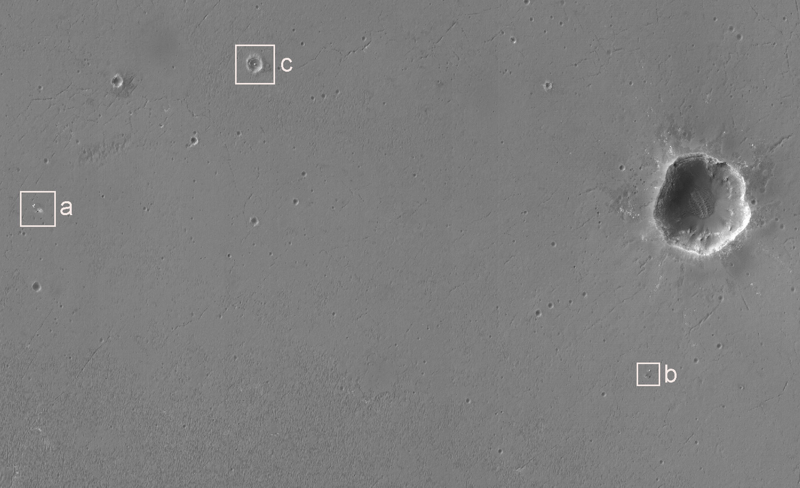 Highlighted Portion of HiRISE Image PSP_001414_1780.
Click the boxes for higher resolution views.
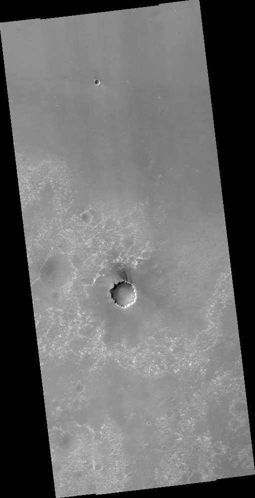
This HiRISE image shows the landing site of the Mars Exploration Rover Opportunity. The prominent impact crater on the right-hand side of the image is "Endurance crater" where Opportunity spent about ten months of its now nearly three-year mission. The bright irregularly-shaped feature in area "a" of the image is Opportunity's parachute, now lying on the martian surface. Near the parachute is the cone-shaped "backshell" that helped protect Opportunity's lander during its seven-month journey to Mars. Dark surface material may have been disturbed when the backshell touched down, exposing the lighter-toned materials seen next to the backshell. Area "b" of the image shows the impact point and the broken remnants of Opportunity's heat shield. The heat shield protected the vehicle during its fiery descent through the martian atmosphere, and then was released from the spacecraft during the final stages of the descent, breaking into two pieces when it hit the martian surface. Also visible is the small crater formed at the heat shield's impact point. Opportunity visited the heat shield during its drive southward from Endurance crater. Area "c" of the image shows "Eagle crater", the small martian impact crater where Opportunity's airbag-cushioned lander came to rest. The lander is still clearly visible on the floor of the crater. Opportunity spent about 60 martian days exploring rock outcrops and soils in Eagle crater before setting off to explore more of Meridiani Planum.
Image PSP_001414_1780 was taken by the High Resolution Imaging Science Experiment (HiRISE) camera onboard the Mars Reconnaissance Orbiter spacecraft on November 14, 2006. The complete image is centered at -2.0 degrees latitude, 354.5 degrees East longitude. The range to the target site was 278.1 km (173.8 miles). At this distance the image scale ranges from 27.8 cm/pixel (with 1 x 1 binning) to 55.6 cm/pixel (with 2 x 2 binning). The image shown here [below] has been map-projected to 25 cm/pixel and north is up. The image was taken at a local Mars time of 3:26 PM and the scene is illuminated from the west with a solar incidence angle of 54 degrees, thus the sun was about 36 degrees above the horizon. At a solar longitude of 135.3 degrees, the season on Mars is Northern Summer.
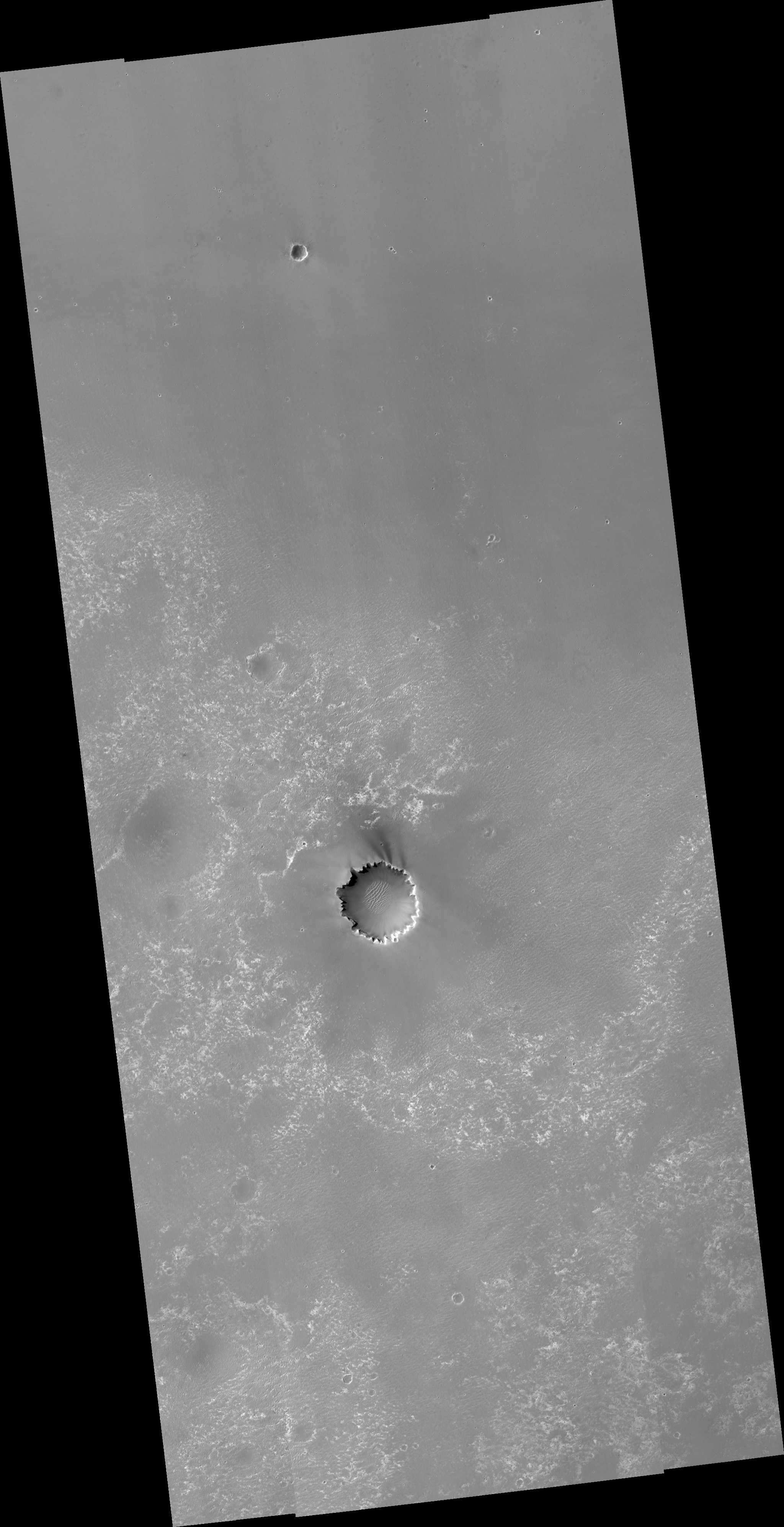 HiRISE Image PSP_001414_1780
Images from the High Resolution Imaging Science Experiment and additional information about the Mars Reconnaissance Orbiter are available online at:
http://hirise.lpl.arizona.edu/
or
For information about NASA and agency programs on the Web, visit: http://www.nasa.gov. NASA's Jet Propulsion Laboratory, a division of the California Institute of Technology in Pasadena, manages the Mars Reconnaissance Orbiter for NASA's Science Mission Directorate, Washington. Lockheed Martin Space Systems is the prime contractor for the project and built the spacecraft. The HiRISE camera was built by Ball Aerospace and Technology Corporation and is operated by the University of Arizona.