Layers in Melas Chasma
 Highlighted Portion of HiRISE Image PSP_001377_1685
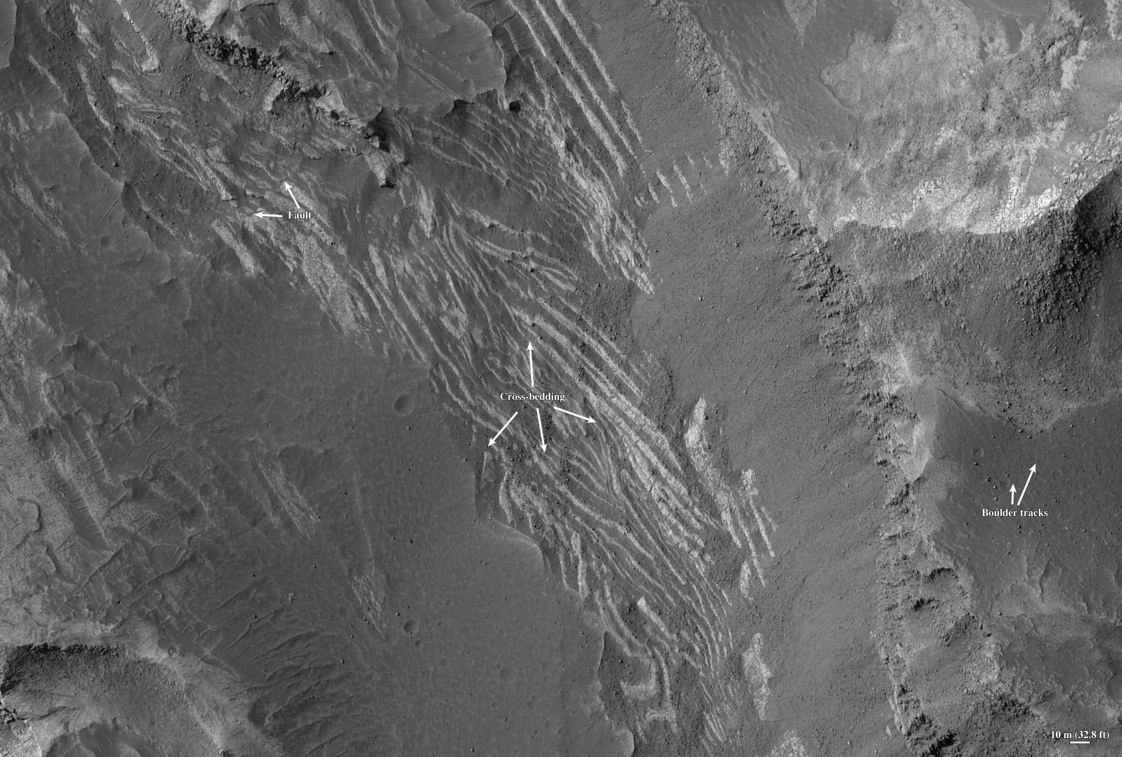
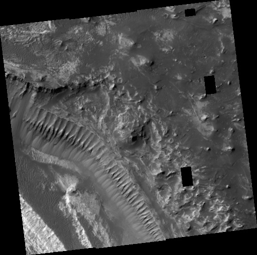
This scene [below] of layered deposits is from Melas Chasma, part of the Valles Marineris valley network. The area consists of a series of plateaus and cliffs that form a step-like terrain similar to the Grand Staircase-Escalante region of southwest Utah. The upper-right half of the image covers the highest plateau, and lower cliffs and plateaus step down in elevation toward the lower left of the image. Dunes of dark sand commonly cover the flat plateaus and distinct layers of bedrock are exposed in the cliffs. The orientations of these layers may help scientists to understand how the layers formed and the kind of environment that the layers formed in. Black rectangles on the left side of the image are areas where the image data was lost during transmission from Mars Reconnaissance Orbiter to Earth. This subscene [above] shows a series of boulder tracks on the left side of the image. The boulders fell from the cliffs above and left behind a series of small depressions. Each depression was made as the boulder bounced and rolled along the surface. In many cases, the tracks can be followed to the specific boulder that made them. Also visible in this subscene are cross-sections through the layered bedrock. This bedrock likely formed through settling of sand-sized particles out of the air or out of a body of water that has since drained away. These layers are 'cross-bedded', which means that subsequent layers are not parallel to each other but are instead oriented at an angle to other layers. The fact that these layers are cross-bedded indicates that the sand-sized particles were moved horizontally along the surface as they settled, just like sand dunes or ripples at the bottom of a stream. The size and shape of these cross-beds may help scientists to determine if the layers formed underwater or on land.
Image PSP_001377_1685 was taken by the High Resolution Imaging Science Experiment (HiRISE) camera onboard the Mars Reconnaissance Orbiter spacecraft on November 11, 2006. The complete image is centered at -11.3 degrees latitude, 286.3 degrees East longitude. The range to the target site was 257.7 km (161.0 miles). At this distance the image scale ranges from 25.8 cm/pixel (with 1 x 1 binning) to 51.6 cm/pixel (with 2 x 2 binning). The image shown here [below] has been map-projected to 25 cm/pixel and north is up. The image was taken at a local Mars time of 3:32 PM and the scene is illuminated from the west with a solar incidence angle of 60 degrees, thus the sun was about 30 degrees above the horizon. At a solar longitude of 133.9 degrees, the season on Mars is Northern Summer.
 HiRISE Image PSP_001377_1685
Images from the High Resolution Imaging Science Experiment and additional information about the Mars Reconnaissance Orbiter are available online at:
http://hirise.lpl.arizona.edu/
or
For information about NASA and agency programs on the Web, visit: http://www.nasa.gov. NASA's Jet Propulsion Laboratory, a division of the California Institute of Technology in Pasadena, manages the Mars Reconnaissance Orbiter for NASA's Science Mission Directorate, Washington. Lockheed Martin Space Systems is the prime contractor for the project and built the spacecraft. The HiRISE camera was built by Ball Aerospace and Technology Corporation and is operated by the University of Arizona.