MOC and HiRISE comparison of Juventae Chasma
 Highlighted Portion of HiRISE Image TRA_000875_1765
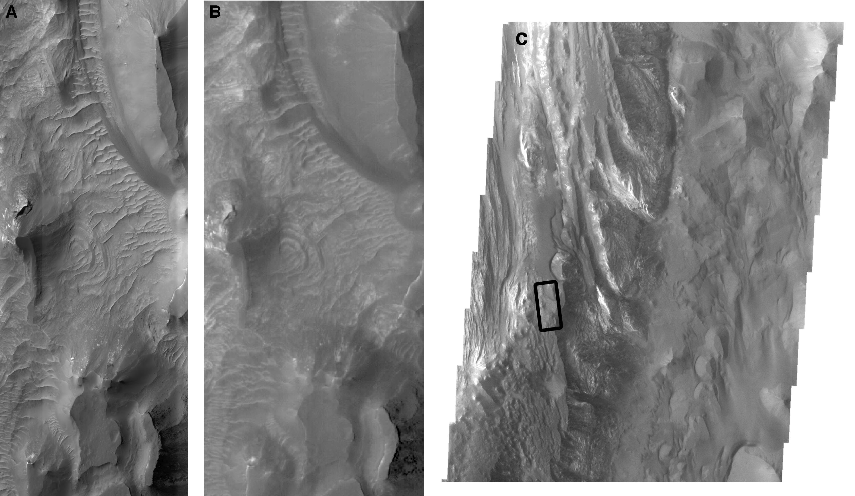
These two images show approximately the same region on the floor of Juventae Chasma. The left image (A) represents a small portion of the HiRISE image taken at ~30 cm/pixel, while the right image (B) represents a sub-image of MOC narrow angle image M04-00651 taken at 4.3 m/pixel resolution. Neither image has been geometrically corrected and both images are 0.90 km in width. At first glance, the two images appear to show similar features. Only when one zooms in to higher resolution on a specific feature is the order of magnitude difference in resolution apparent between the two cameras. Impact craters only a few meters in diameter can be identified in the HiRISE image but are not resolvable in the MOC image. The number of craters on a surface can be used to determine a relative age so it is important to resolve as many craters as possible in order to make the best estimate of age for a geologic unit. Linear features in the MOC image could be eolian ripples, faults, fractures, or layering in the rocks. In the HiRISE sub-image, the higher resolution enables us to identify which of these features is associated with each lineation. The image shown to the far right (C) is a portion of THEMIS visible image V01788002 acquired at 18 m/pixel resolution with a width of 18.43 km. The black box shows the location of the MOC and HiRISE sub-images, which are on light-toned layered material along the floor of Juventae Chasma. The MOC and HiRISE sub-image do not show much of this light-toned layered deposit because there is a mantle of dark material and ripples obscuring the layered deposit beneath.
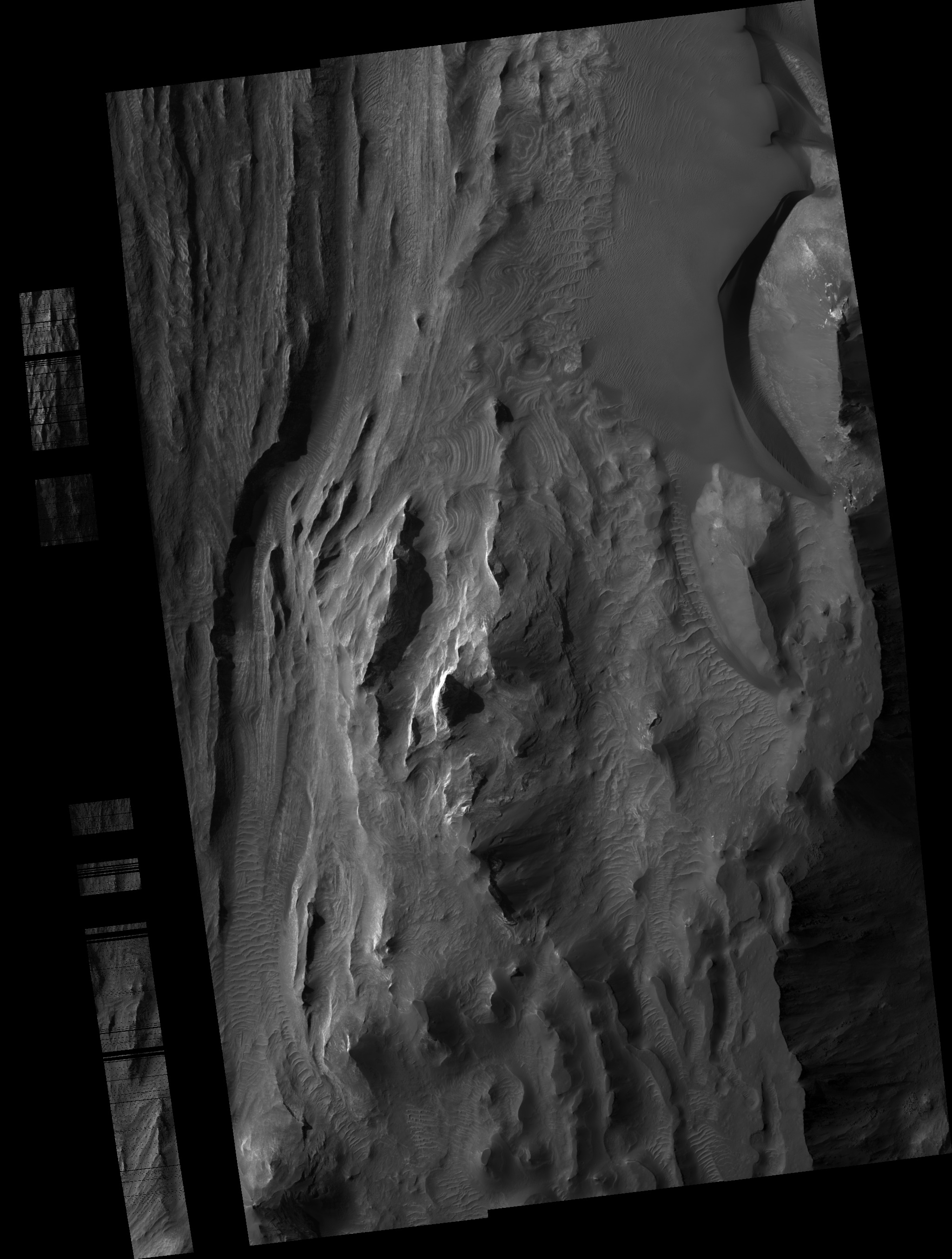
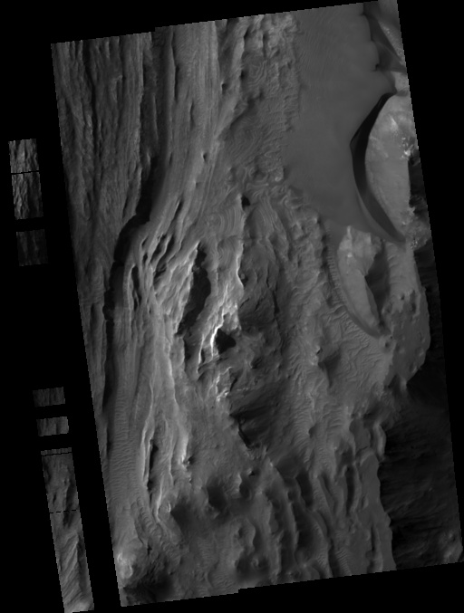
Image TRA_000875_1765 was taken by the High Resolution Imaging Science Experiment (HiRISE) camera onboard the Mars Reconnaissance Orbiter spacecraft on October 3, 2006. The complete image is centered at -3.6 degrees latitude, 298.2 degrees East longitude. The range to the target site was 295.0 km (184.4 miles). At this distance the image scale ranges from 29.5 cm/pixel (with 1 x 1 binning) to 59.0 cm/pixel (with 2 x 2 binning). The image shown here [below] has been map-projected to 25 cm/pixel and north is up. The image was taken at a local Mars time of 3:20 PM and the scene is illuminated from the west with a solar incidence angle of 55 degrees, thus the sun was about 35 degrees above the horizon. At a solar longitude of 115.4 degrees, the season on Mars is Northern Summer.
 HiRISE Image TRA_000875_1765
Images from the High Resolution Imaging Science Experiment and additional information about the Mars Reconnaissance Orbiter are available online at:
http://hirise.lpl.arizona.edu/
or
For information about NASA and agency programs on the Web, visit: http://www.nasa.gov. NASA's Jet Propulsion Laboratory, a division of the California Institute of Technology in Pasadena, manages the Mars Reconnaissance Orbiter for NASA's Science Mission Directorate, Washington. Lockheed Martin Space Systems is the prime contractor for the project and built the spacecraft. The HiRISE camera was built by Ball Aerospace and Technology Corporation and is operated by the University of Arizona.