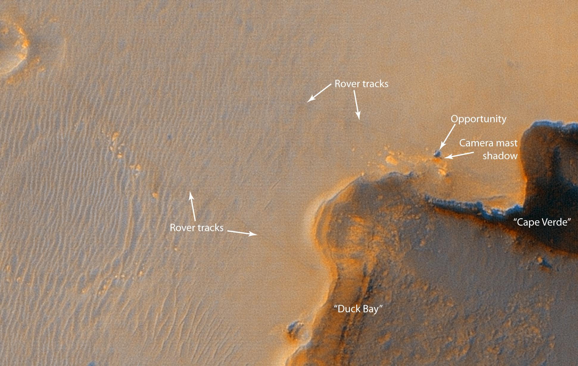
The Opportunity rover
at "Victoria Crater"
 The Opportunity rover at "Victoria Crater" as seen by the
High Resolution Imaging Science Experiment (HiRISE).
Move your mouse cursor over the image to view labels.
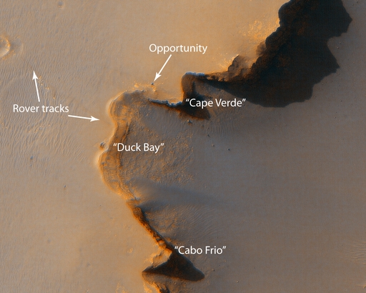
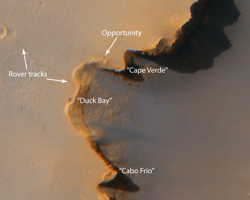
This HiRISE image shows the Mars Exploration rover Opportunity near the rim of "Victoria Crater." Victoria is an impact crater ~800 meters (about half a mile) in diameter at Meridiani Planum near the equator of Mars. Opportunity has been operating on Mars since January, 2004. Five days before this image was taken, Opportunity arrived at the rim of Victoria Crater, after a drive of more than 9 km (over 5 miles). It then drove to the position where it is seen in this image.
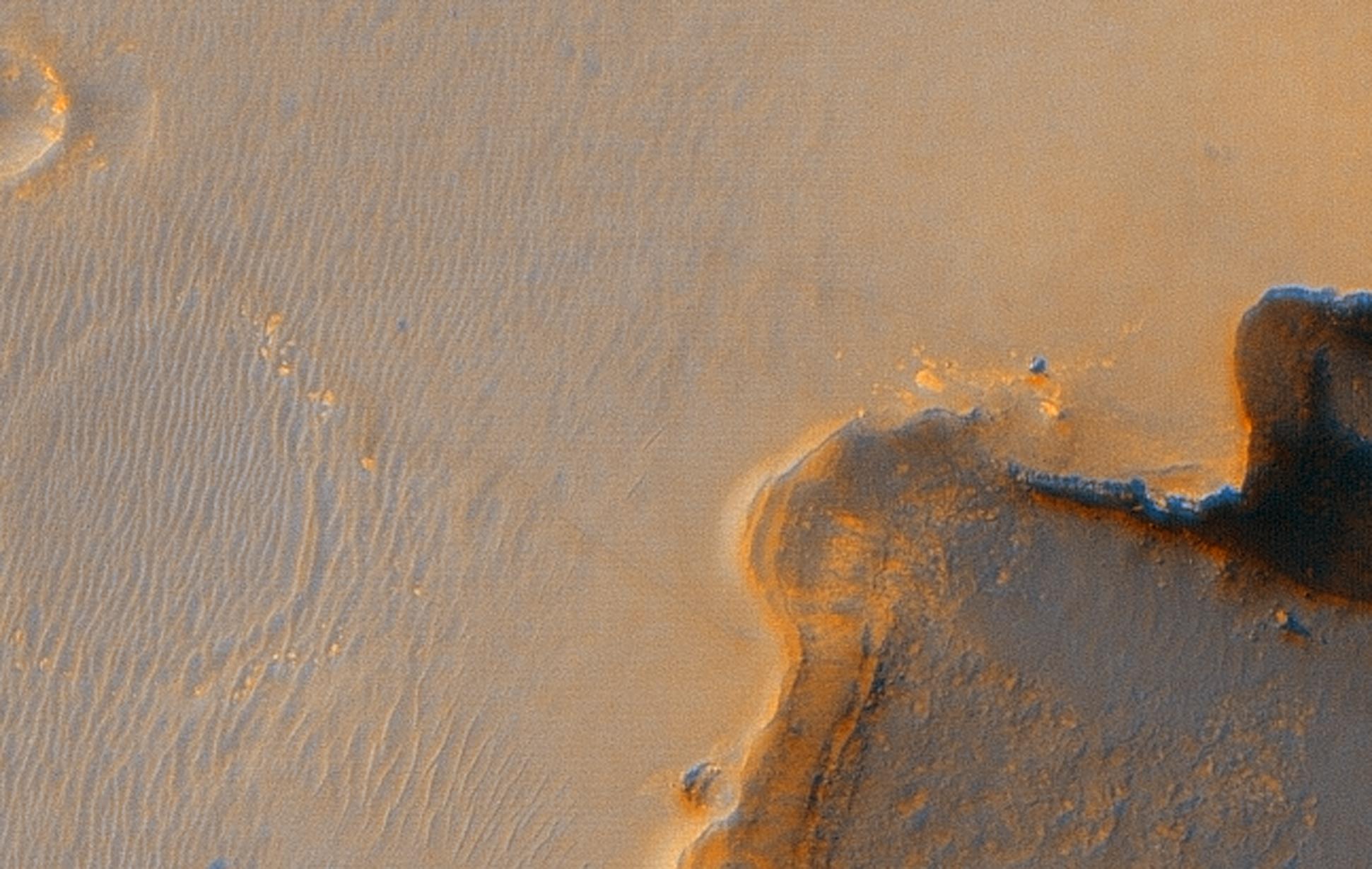
Shown in the image are "Duck Bay", the eroded segment of the crater rim where Opportunity first arrived at the crater, "Cabo Frio", a sharp promontory to the south of Duck Bay, and "Cape Verde" another promontory to the north. When viewed at the highest resolution, this image shows the rover itself, wheel tracks in the soil behind it, and the rover's shadow, including the shadow of the camera mast. Since this image was taken, Opportunity has moved to the very tip of Cape Verde to perform more imaging of the interior of the crater.
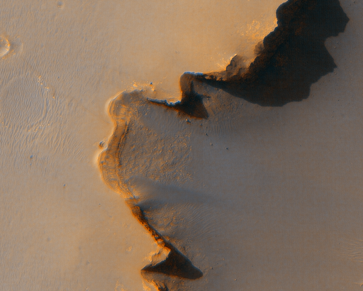
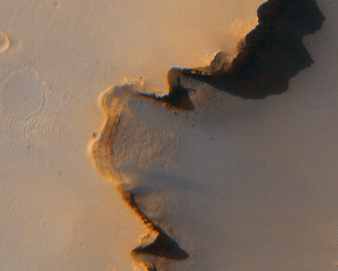
 The Opportunity rover at high resolution.
Move your mouse cursor over the image to view labels.
Color fringes in these images are an artifact due to the preliminary nature of the HiRISE color processing algorithm.
Image TRA_000873_1780 was taken by the High Resolution Imaging Science Experiment (HiRISE) camera onboard the Mars Reconnaissance Orbiter spacecraft on October 3, 2006. Shown here is a portion of the complete image. The complete image is centered at -2.1 degrees latitude, 354.5 degrees East longitude. The range to the target site was 269 km (168 miles). At this distance the image scale is 27 cm/pixel (with 1 x 1 binning) so objects ~81 cm across are resolved. The image was taken at a local Mars time of 3:28 PM and the scene is illuminated from the west with a solar incidence angle of 56.2 degrees, thus the sun was about 33.8 degrees above the horizon. At a solar longitude of 115.3 degrees, the season on Mars is Northern Summer.
Images from the High Resolution Imaging Science Experiment and additional information about the Mars Reconnaissance Orbiter are available online at:
http://www.nasa.gov/mro
or
http://HiRISE.lpl.arizona.edu.
For information about NASA and agency programs on the Web, visit: http://www.nasa.gov. NASA's Jet Propulsion Laboratory, a division of the California Institute of Technology in Pasadena, manages the Mars Reconnaissance Orbiter for NASA's Science Mission Directorate, Washington. Lockheed Martin Space Systems is the prime contractor for the project and built the spacecraft. The HiRISE camera was built by Ball Aerospace and Technology Corporation and is operated by the University of Arizona.