Possible Remnant Mantle
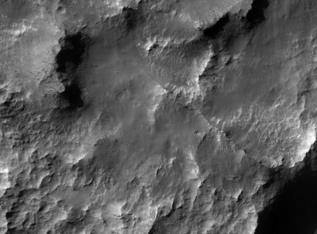 Highlighted Portion of HiRISE Image TRA_000853_1450
This HiRISE image covers a small area within a degraded crater adjacent to Atlantis Chaos in the Electris region of Mars. The crater and much of the surrounding region were once extensively mantled by a layer of material(s) of unknown origin and only small remnant outcrops of this material remain seen as flat topped mesas in the image sub-frame shown here. Intervening areas expose ancient uplands materials locally punctuated by narrow ridges that may represent more resistant material within the mantling deposit that were left in relief as the sediments were eroded away. Although the mesas do not appear to be comprised of finely layered materials, hints of some layering in a few locations can be seen. Large blocks of material are being shed from the mesas, but do not appear to accumulate on the mesa slopes as large talus aprons. Some wind blown dunes and ripples can be observed, but are not as widespread as in many other locations imaged with HiRISE. Collectively, these characteristics suggest that the material(s) forming the mantling deposit possess some limited strength, but are easily broken down and removed by wind over time. One possible Earth analog for these deposits may be the wind blown accumulations of very fine sediments, or silt known as loess.
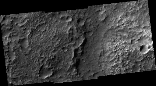
Image TRA_000853_1450 was taken by the High Resolution Imaging Science Experiment (HiRISE) camera onboard the Mars Reconnaissance Orbiter spacecraft on October 1, 2006. The complete image is centered at -34.7 degrees latitude, 184.5 degrees East longitude. The range to the target site was 253.0 km (158.1 miles). At this distance the image scale ranges from 50.6 cm/pixel (with 2 x 2 binning) to 101.3 cm/pixel (with 4 x 4 binning). The image shown here [below] has been map-projected to 50 cm/pixel and north is up. The image was taken at a local Mars time of 3:34 PM and the scene is illuminated from the west with a solar incidence angle of 77 degrees, thus the sun was about 13 degrees above the horizon. At a solar longitude of 114.6 degrees, the season on Mars is Northern Summer.
 HiRISE Image TRA_000853_1450
Images from the High Resolution Imaging Science Experiment and additional information about the Mars Reconnaissance Orbiter are available online at:
http://hirise.lpl.arizona.edu/
or
For information about NASA and agency programs on the Web, visit: http://www.nasa.gov. NASA's Jet Propulsion Laboratory, a division of the California Institute of Technology in Pasadena, manages the Mars Reconnaissance Orbiter for NASA's Science Mission Directorate, Washington. Lockheed Martin Space Systems is the prime contractor for the project and built the spacecraft. The HiRISE camera was built by Ball Aerospace and Technology Corporation and is operated by the University of Arizona.