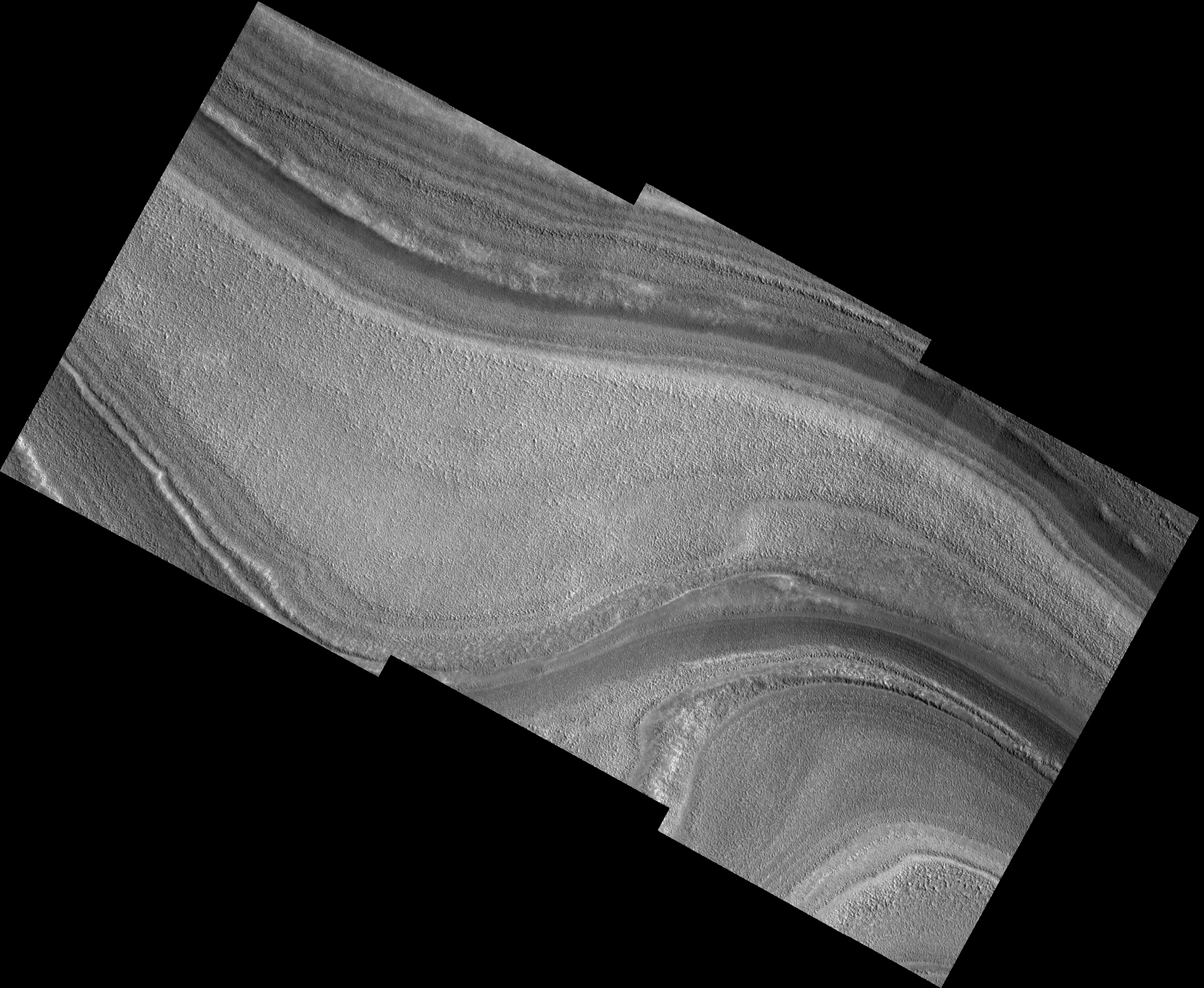
Polar Layers Near Chasma Boreale
 HiRISE Image TRA_000840_2750
This is an image of the north polar layered deposits (NPLD) near the source region of Chasma Boreale. Chasma Boreale is the largest re-entrant trough in the NPLD, with its head region located roughly 300 km from the north pole and its mouth opening into the northern plains at the perimeter of the NPLD. Chasma Boreale is thought to have formed due to outflow of water from underneath the polar cap, or due to winds blowing off the polar cap, or a combination of both. Investigation of the currently visible layers around the source region may tell us if they have been deformed and down-dropped, perhaps by melting and flow of water beneath, or if they remain undisturbed. Layers here do not appear as fine as elsewhere in polar trough exposures, although this may be due to the relatively gently sloping exposure here. Different layers show very different degrees of roughness and pitting, although the texture within a layer is quite consistent. One of the layers even displays a texture of polygons 3-10 m across, normally associated with periglacial freeze-thaw processes on Earth. Layers of different texture, brightness, and appearance indicate differing physical properties, composition, and exposure to surface environmental conditions at time of emplacement and/or erosion. In this way, polar layers on Mars record a history of climate conditions as sequences of layers on Earth often do.
Image TRA_000840_2750 was taken by the High Resolution Imaging Science Experiment (HiRISE) camera onboard the Mars Reconnaissance Orbiter spacecraft on September 30, 2006. The complete image is centered at 84.7 degrees latitude, 15.8 degrees East longitude. The range to the target site was 318.7 km (199.2 miles). At this distance the image scale ranges from 31.9 cm/pixel (with 1 x 1 binning) to 127.5 cm/pixel (with 4 x 4 binning). The image shown here has been map-projected to 25 cm/pixel. The image was taken at a local Mars time of 5:21 AM and the scene is illuminated from the west with a solar incidence angle of 68 degrees, thus the sun was about 22 degrees above the horizon. At a solar longitude of 114.2 degrees, the season on Mars is Northern Summer.
Images from the High Resolution Imaging Science Experiment and additional information about the Mars Reconnaissance Orbiter are available online at:
http://hirise.lpl.arizona.edu/
or
For information about NASA and agency programs on the Web, visit: http://www.nasa.gov. NASA's Jet Propulsion Laboratory, a division of the California Institute of Technology in Pasadena, manages the Mars Reconnaissance Orbiter for NASA's Science Mission Directorate, Washington. Lockheed Martin Space Systems is the prime contractor for the project and built the spacecraft. The HiRISE camera was built by Ball Aerospace and Technology Corporation and is operated by the University of Arizona.