Southern Edge of Elysium Planitia
 Highlighted Portion of HiRISE Image TRA_000840_1810
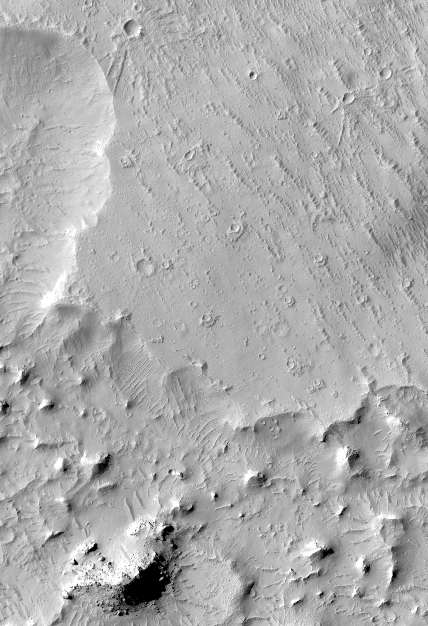
This sub-image (of HiRISE image TRA_000840_1810 [below]) is located on the southern margin of Elysium Planitia, in the equatorial region of Mars. A scarp (cliff) winds through the scene, dividing the lower knobby terrain to the southwest from the higher terrain to the northeast. The scarp offers a glimpse into the material that underlies the higher terrain. No prominent layers are seen in the vertical face of the scarp, and boulders have not accumulated around its base. This suggests that, by and large, the elevated northeastern terrain is not made of hard rock; however, it is also possible that rocks are present but buried under sediments. Several of the impact craters in the northern part of the sub-image are "pedestal craters," which have raised ejecta (fragmented material thrown out of the crater upon impact). The ejecta was not always raised like this. Being more resistant to erosion, it was left high-standing after the surrounding material was removed, probably by wind. In addition to being raised, the ejecta around these craters is asymmetric - it is skewed towards the southeast. This might be because the craters formed when objects struck the surface of Mars at an angle, or perhaps erosion has preferentially removed the ejecta on the northwest sides of the impact craters. The knobby terrain southwest of the scarp is riddled with wind-blown dunes. The dunes radiate out around the bases of the knobs indicating that they are more strongly influenced by local topography than regional winds. Small boulders on the flanks of a few knobs reveal that they contain rocky material.
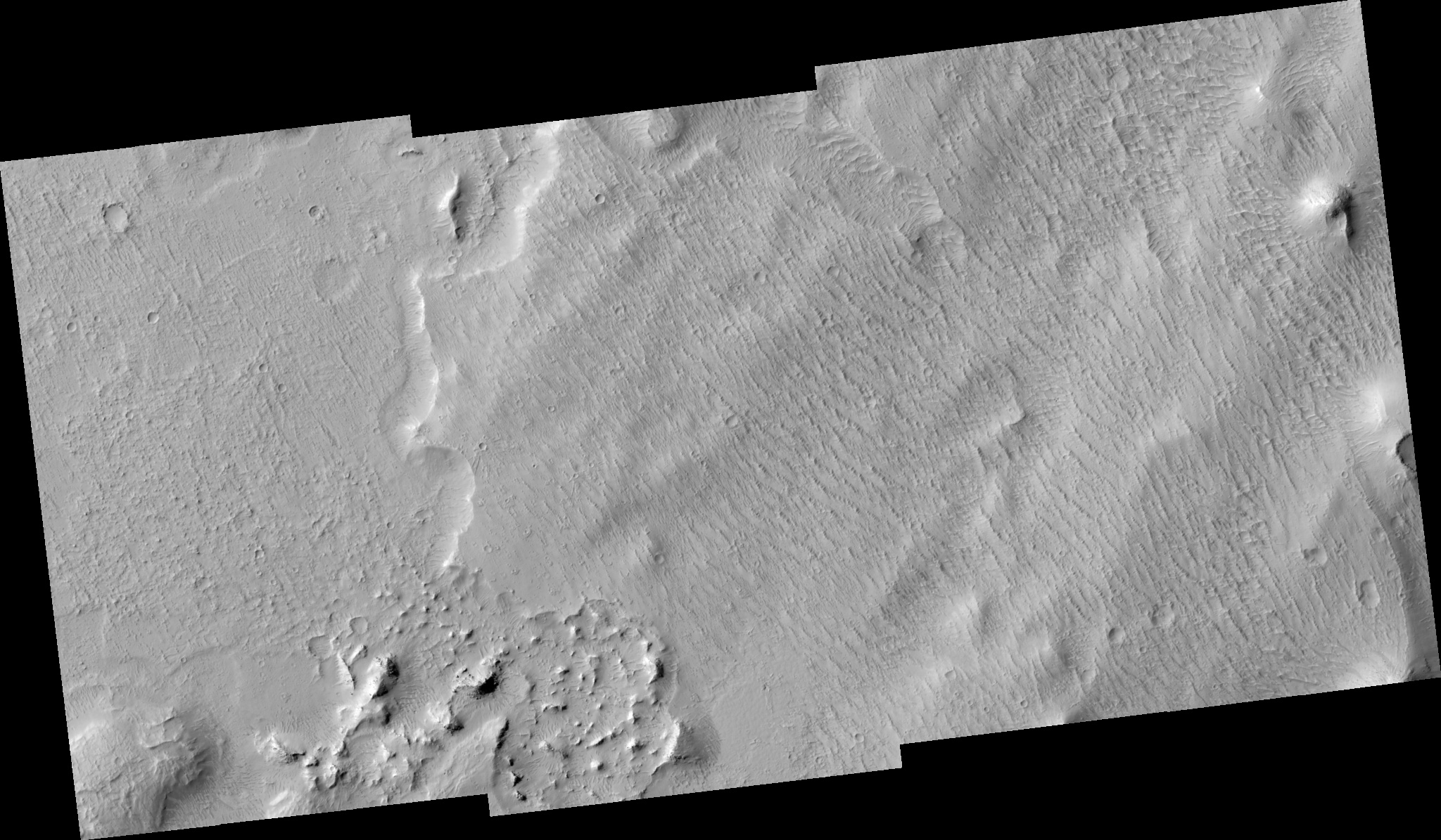
Image TRA_000840_1810 was taken by the High Resolution Imaging Science Experiment (HiRISE) camera onboard the Mars Reconnaissance Orbiter spacecraft on September 30, 2006. The complete image is centered at 1.0 degrees latitude, 174.6 degrees East longitude. The range to the target site was 271.8 km (169.9 miles). At this distance the image scale ranges from 54.4 cm/pixel (with 2 x 2 binning) to 108.8 cm/pixel (with 4 x 4 binning). The image shown here [below] has been map-projected to 50 cm/pixel and north is up. The image was taken at a local Mars time of 3:27 PM and the scene is illuminated from the west with a solar incidence angle of 55 degrees, thus the sun was about 35 degrees above the horizon. At a solar longitude of 114.2 degrees, the season on Mars is Northern Summer.
 HiRISE Image TRA_000840_1810
Images from the High Resolution Imaging Science Experiment and additional information about the Mars Reconnaissance Orbiter are available online at:
http://hirise.lpl.arizona.edu/
or
For information about NASA and agency programs on the Web, visit: http://www.nasa.gov. NASA's Jet Propulsion Laboratory, a division of the California Institute of Technology in Pasadena, manages the Mars Reconnaissance Orbiter for NASA's Science Mission Directorate, Washington. Lockheed Martin Space Systems is the prime contractor for the project and built the spacecraft. The HiRISE camera was built by Ball Aerospace and Technology Corporation and is operated by the University of Arizona.