Mars Exploration Rover Landing Site at Gusev Crater
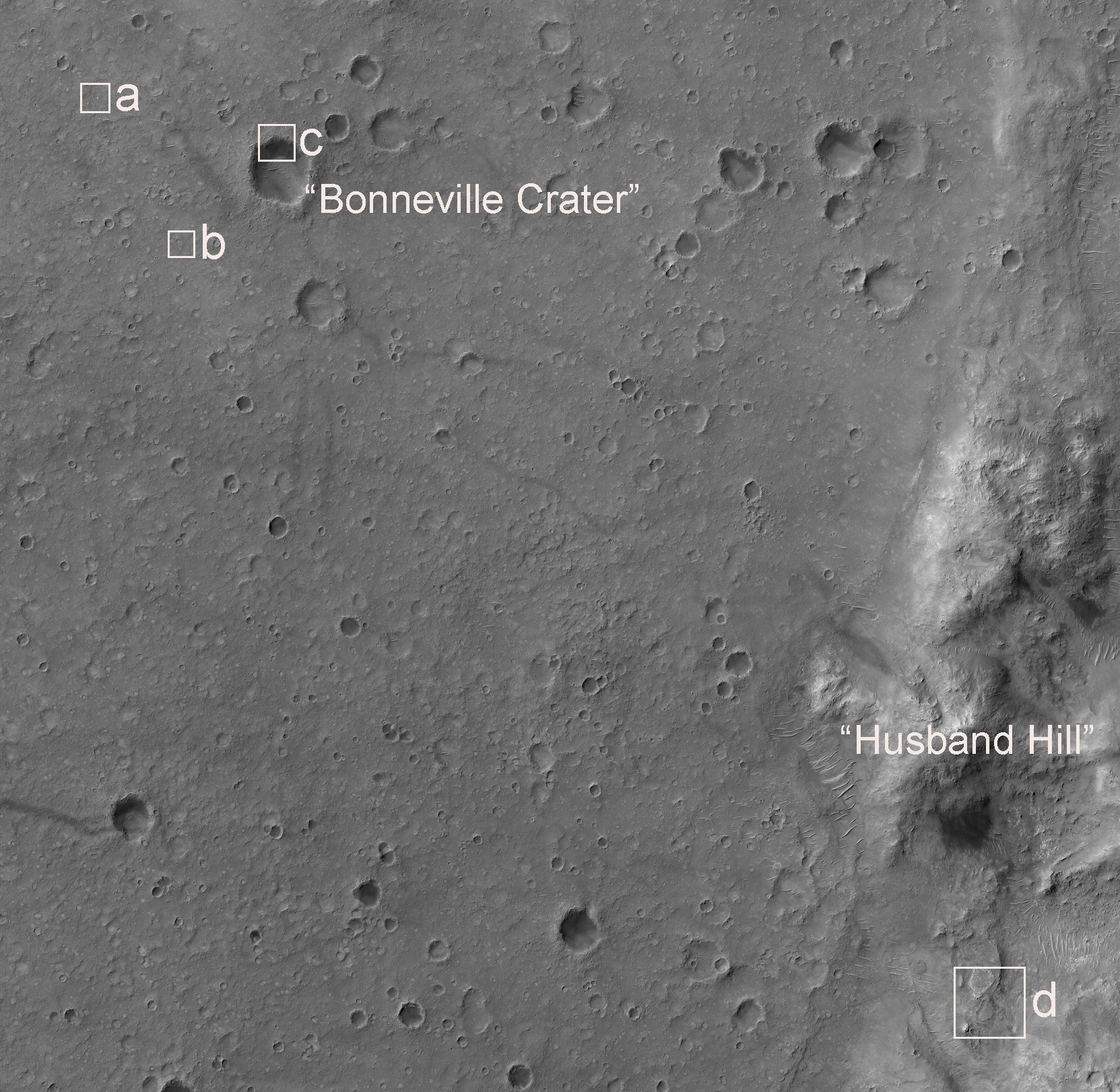 Highlighted Portion of HiRISE Image PSP_001513_1655.
Click the boxes for higher resolution views.
This HiRISE image shows the landing site of the Mars Exploration Rover Spirit. The impact crater in the upper left-hand portion of the image is "Bonneville Crater," which was investigated by Spirit shortly after landing. In the lower right-hand portion of the image is "Husband Hill," a large hill that Spirit climbed and where it spent much of its now nearly three-year mission. The bright irregularly-shaped feature in area "A" of the image is Spirit's parachute, now lying on the Martian surface. Near the parachute is the cone-shaped "backshell" that helped protect Spirit's lander during its seven-month journey to Mars. The backshell appears relatively undamaged by its impact with the martian surface. Wrinkles and folds in the parachute fabric are clearly visible. Area "B" of the image shows Spirit's lander. The crater in the upper left-hand portion of the image, just to the northwest of the lander, is the one that the Mars Exploration Rover team named "Sleepy Hollow." Area "C" shows the damaged remnant of the heat shield that protected the vehicle during the high-speed entry through the Martian atmosphere. The heat shield impacted the surface after being separated from the vehicle during the final stages of the descent. Area "D" of the image shows the current location of Spirit. Toward the top of the image is "Home Plate," a plateau of layered rocks that Spirit explored during the early part of its third year on Mars. Spirit itself is clearly seen just to the southeast of Home Plate. Also visible are the tracks made by the rover before it arrived at its current location.
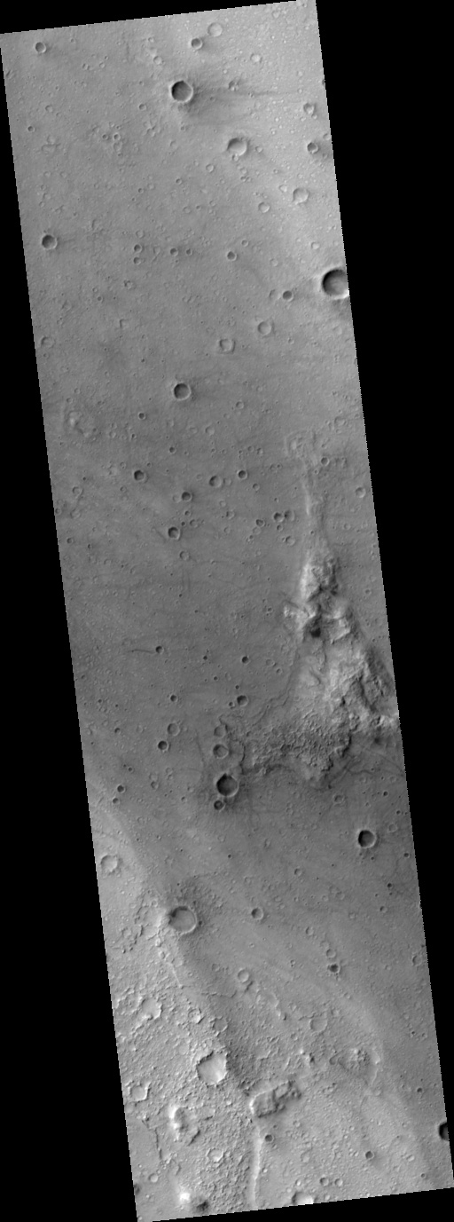
Image PSP_001513_1655 was taken by the High Resolution Imaging Science Experiment (HiRISE) camera onboard the Mars Reconnaissance Orbiter spacecraft on November 22, 2006. The complete image is centered at -14.6 degrees latitude, 175.5 degrees East longitude. The range to the target site was 270.7 km (169.2 miles). At this distance the image scale is 27.1 cm/pixel (with 1 x 1 binning) so objects ~81 cm across are resolved. The image shown here [below] has been map-projected to 25 cm/pixel and north is up. The image was taken at a local Mars time of 3:29 PM and the scene is illuminated from the west with a solar incidence angle of 60 degrees, thus the sun was about 30 degrees above the horizon. At a solar longitude of 139.1 degrees, the season on Mars is Northern Summer.
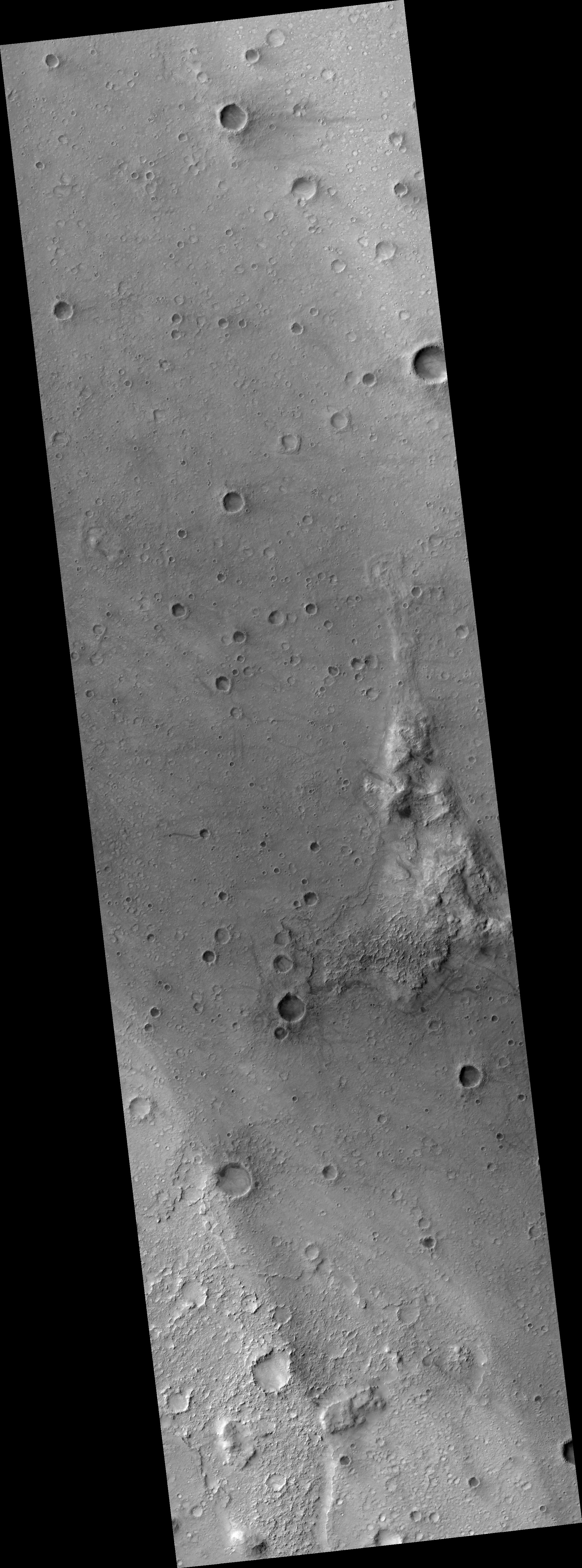 HiRISE Image PSP_001513_1655
Images from the High Resolution Imaging Science Experiment and additional information about the Mars Reconnaissance Orbiter are available online at:
http://hirise.lpl.arizona.edu/
or
For information about NASA and agency programs on the Web, visit: http://www.nasa.gov. NASA's Jet Propulsion Laboratory, a division of the California Institute of Technology in Pasadena, manages the Mars Reconnaissance Orbiter for NASA's Science Mission Directorate, Washington. Lockheed Martin Space Systems is the prime contractor for the project and built the spacecraft. The HiRISE camera was built by Ball Aerospace and Technology Corporation and is operated by the University of Arizona.