Enigmatic Ice Mound
 HiRISE Image PSP_001370_2505
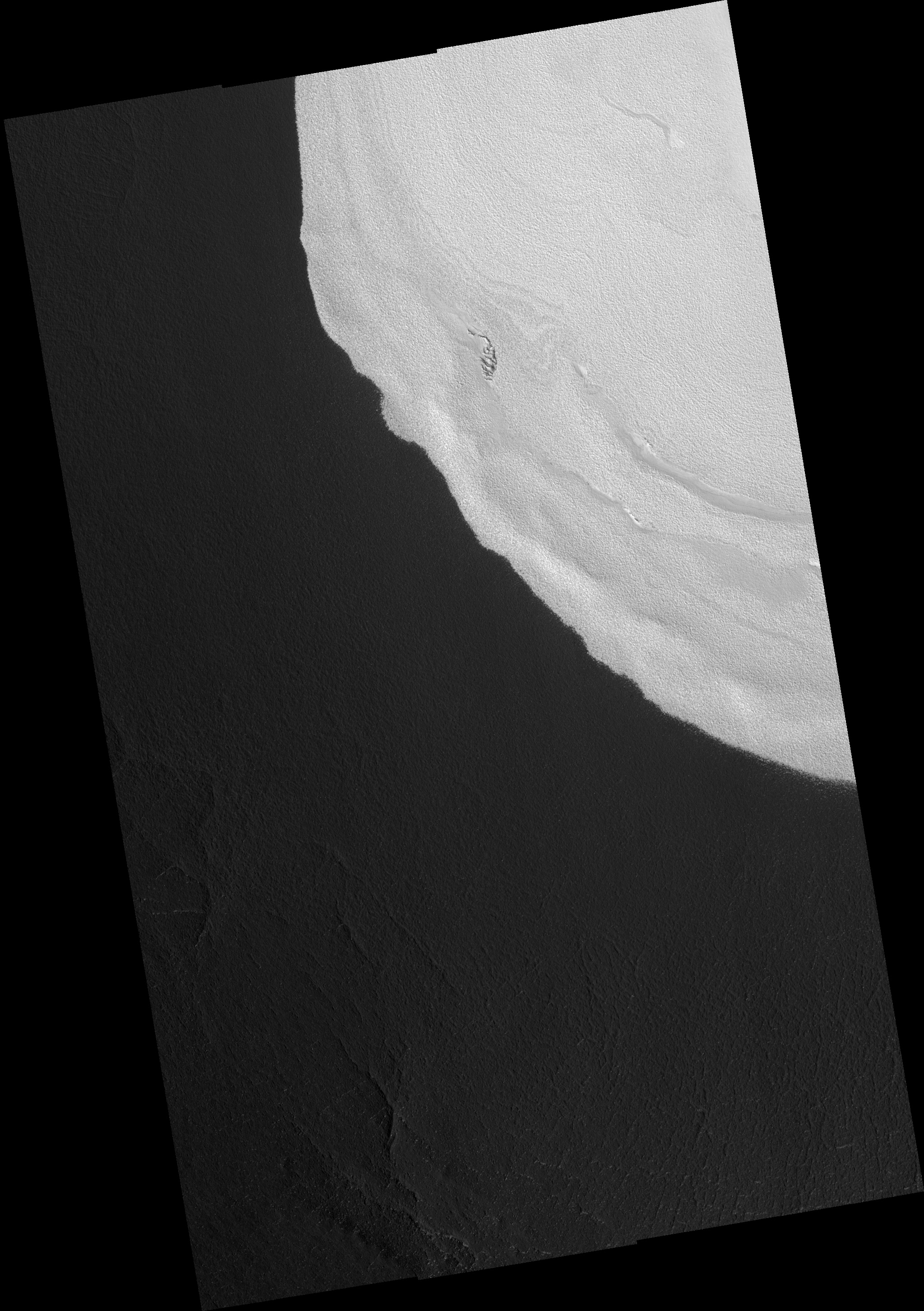
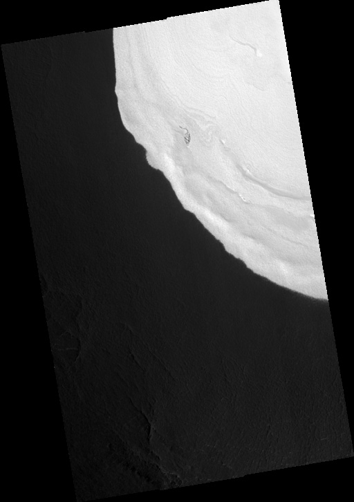
This full HiRISE image shows the edge of an ice mound located inside a 1.5 Km (~1 mile) deep impact crater a few hundred kilometers south of the northern permanent ice cap. The ice-mound is up to 200m (656 feet) thick at its center and much thinner here at its edge. Similar surface textures within and around the ice deposit indicate that the ice is thin here. It is somewhat of a mystery as to why this mound of ice survives in such a southerly location where temperatures are much warmer than those at the north pole. The brightness of the ice itself has a self-preservation effect: bright surfaces remain cooler, which limits the amount of ice lost during the summer. The adjacent ice-free dark surfaces get much warmer, which means that fresh ice cannot form there. These feedback effects are the reason that the edge of this ice-covered area is so sharp. The puzzling part of the story is that there are nearby, similarly-sized craters which are ice-free. Some special property of this particular crater allowed the ice to be either originally deposited there and not in other craters or retained here and lost in other craters. Possibilities for this special property include a local source of water unique to this crater or unusual weather conditions associated with this crater but not others.
Image PSP_001370_2505 was taken by the High Resolution Imaging Science Experiment (HiRISE) camera onboard the Mars Reconnaissance Orbiter spacecraft on November 11, 2006. The complete image is centered at 70.1 degrees latitude, 103.0 degrees East longitude. The range to the target site was 314.1 km (196.3 miles). At this distance the image scale ranges from 31.4 cm/pixel (with 1 x 1 binning) to 62.9 cm/pixel (with 2 x 2 binning). The image shown here has been map-projected to 25 cm/pixel. The image was taken at a local Mars time of 3:00 PM and the scene is illuminated from the west with a solar incidence angle of 59 degrees, thus the sun was about 31 degrees above the horizon. At a solar longitude of 133.7 degrees, the season on Mars is Northern Summer.
Images from the High Resolution Imaging Science Experiment and additional information about the Mars Reconnaissance Orbiter are available online at:
http://hirise.lpl.arizona.edu/
or
For information about NASA and agency programs on the Web, visit: http://www.nasa.gov. NASA's Jet Propulsion Laboratory, a division of the California Institute of Technology in Pasadena, manages the Mars Reconnaissance Orbiter for NASA's Science Mission Directorate, Washington. Lockheed Martin Space Systems is the prime contractor for the project and built the spacecraft. The HiRISE camera was built by Ball Aerospace and Technology Corporation and is operated by the University of Arizona.